
The Rural
Assistance Center (RAC is pleased to announce the addition of two new
maps featuring data on 1) American Indian and Alaska Native Population and
2) Black or African American Population.
American
Indian and Alaska Native Population
Printable map that shows the percent of the U.S. population by county who are American Indian or Alaska Native. Data source: Source: U.S. Census Bureau, Census 2010. 2010 Census Summary File 1.
Printable map that shows the percent of the U.S. population by county who are American Indian or Alaska Native. Data source: Source: U.S. Census Bureau, Census 2010. 2010 Census Summary File 1.
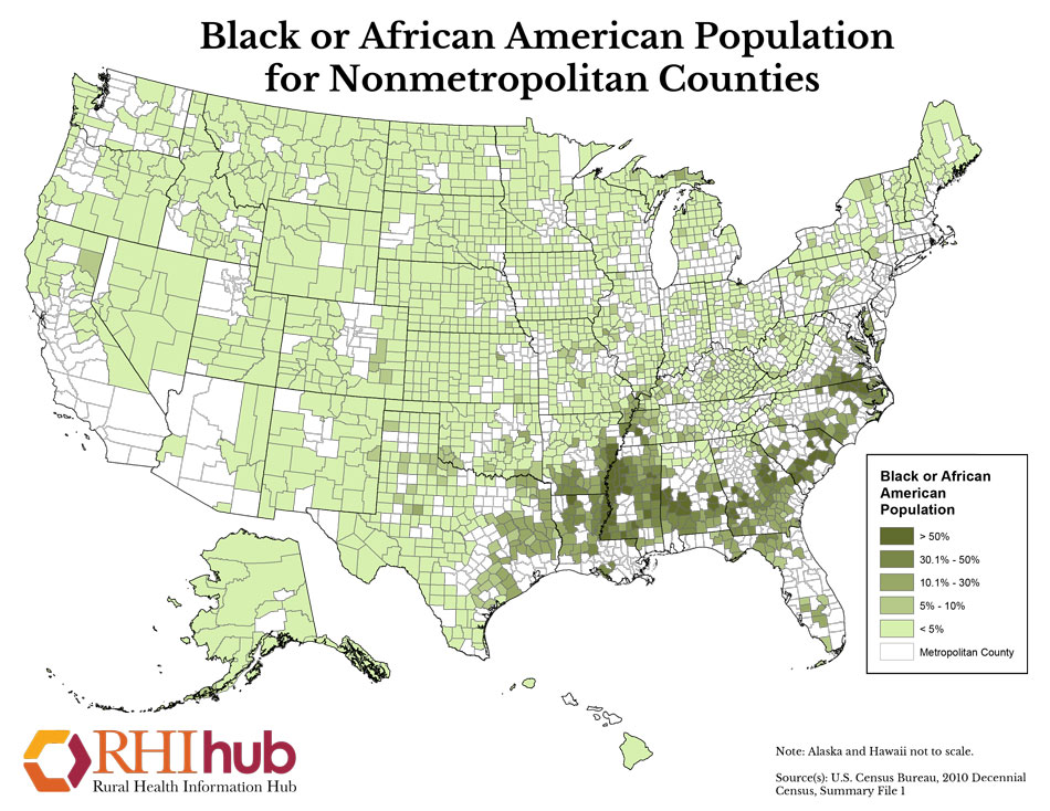
Black
or African American Population
Printable map that shows the percent of the U.S. population by county who are Black or African American. Source: U.S. Census Bureau, Census 2010.
Printable map that shows the percent of the U.S. population by county who are Black or African American. Source: U.S. Census Bureau, Census 2010.
RAC maps can be customized for use in grant proposals and
other publications. Maps can be adapted to show county, region or
state-specific information. The Interactive Mapping System also allows for
customization of labels, boundaries and other features. RUPRI’s Center for
Applied Research and Environmental Systems (CARES) has worked with the Rural
Assistance Center to provide a collection of 37
maps on rural topics.
·
Funding
Directory: Includes summaries of up-to-date funding opportunities
searchable by state, type, topic and sponsor.
·
Topic
Guides: Provide a full range of resources including documents, tools,
organizations, news, events, success stories and more!
·
RAC
Updates: Be in the know! Get all the updates on the latest rural health or
human service news, funding opportunities, upcoming events, etc.
To learn more or customize your own map Click Here.